Friday, October 17, 2014

Hat Point Lookout


It's a rainy Friday evening in Portland and a good time to remember one of the last warm weather rides of the year.  A few weekends ago we drove 5 1/2 hours to the eastern Oregon town of Joseph, named after Chief Joseph of the Nez Perce tribe. Chief Joseph led his band when they were forcibly removed from their lands in the Wallowa Valley by the U.S. government. They were pursued 1,170 to Canada in a "fighting retreat" by the U.S. Army in what became known as the Nez Perce War. He lost his land but they named a town after him.

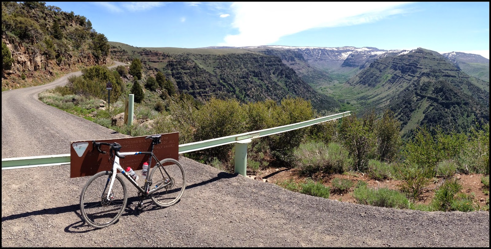
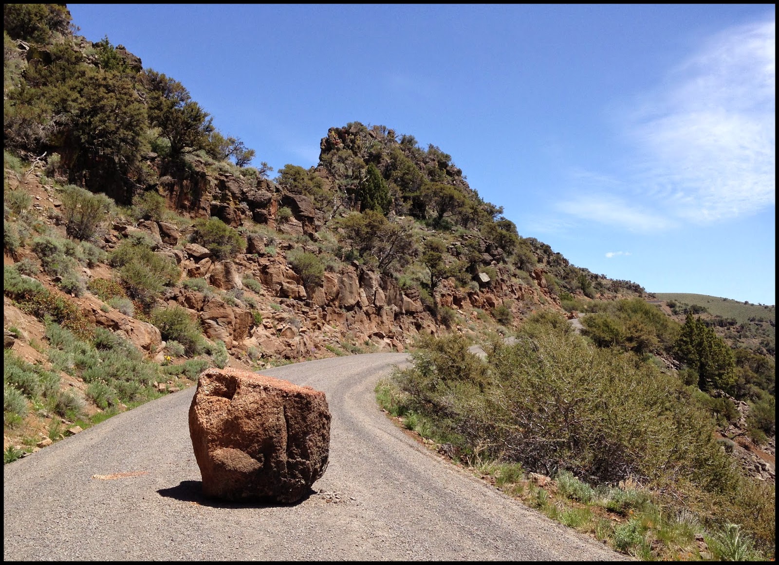
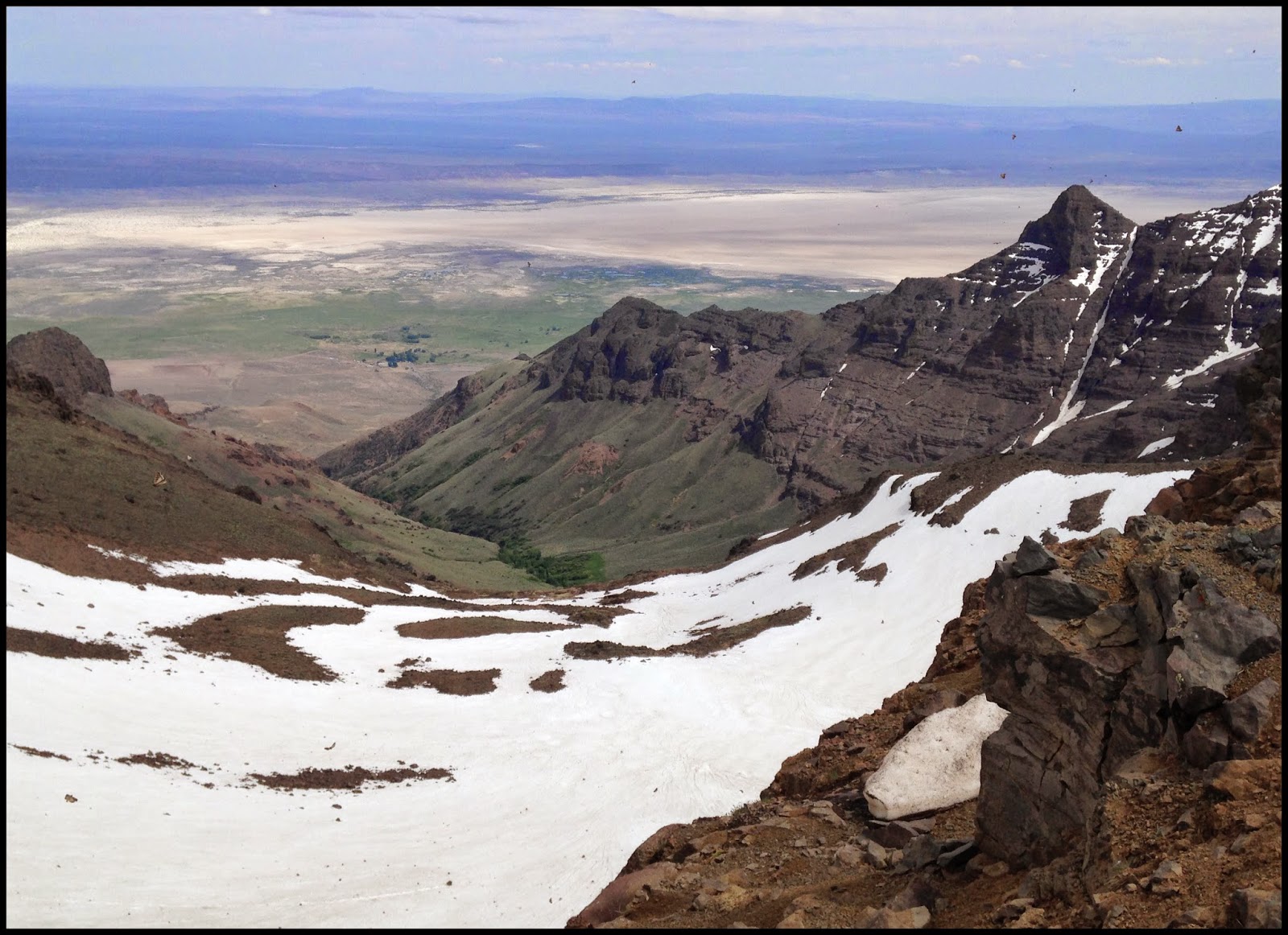
We first visited Joseph 15 or so years ago. We hiked to Ice Lake (a difficult 14 mile roundtrip that I no longer have the inclination to do) and went site-seeing "off road" in our then new Jeep. One of these off road ventures was to Hat Point Lookout, an observation tower 24 miles up a gravel road from the blink-and-you-miss-it town of Imnaha. Hat Point sits on a rim above Hells Canyon, with views to the Snake River below and Idaho's Seven Devils Mountains across the canyon.

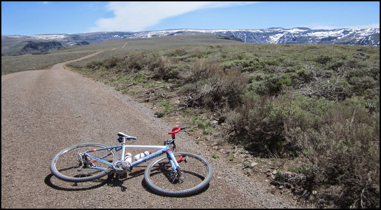
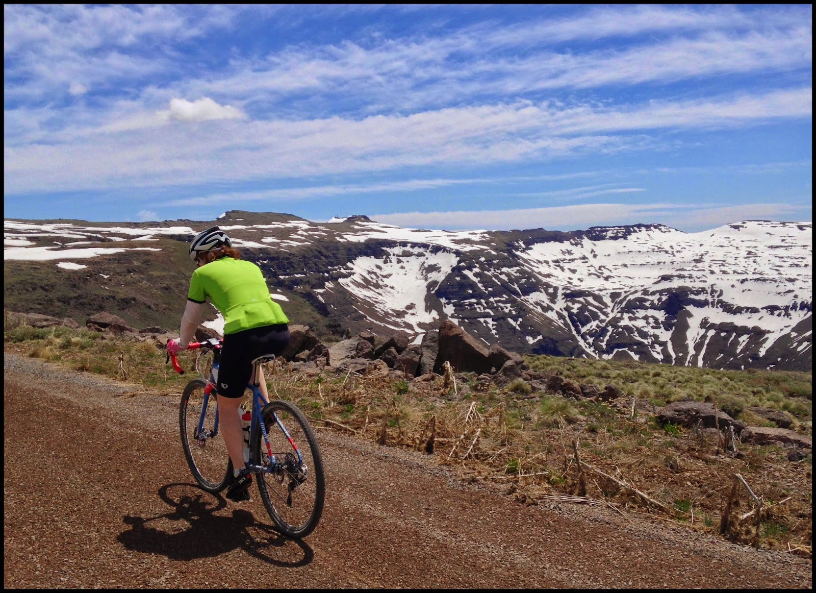
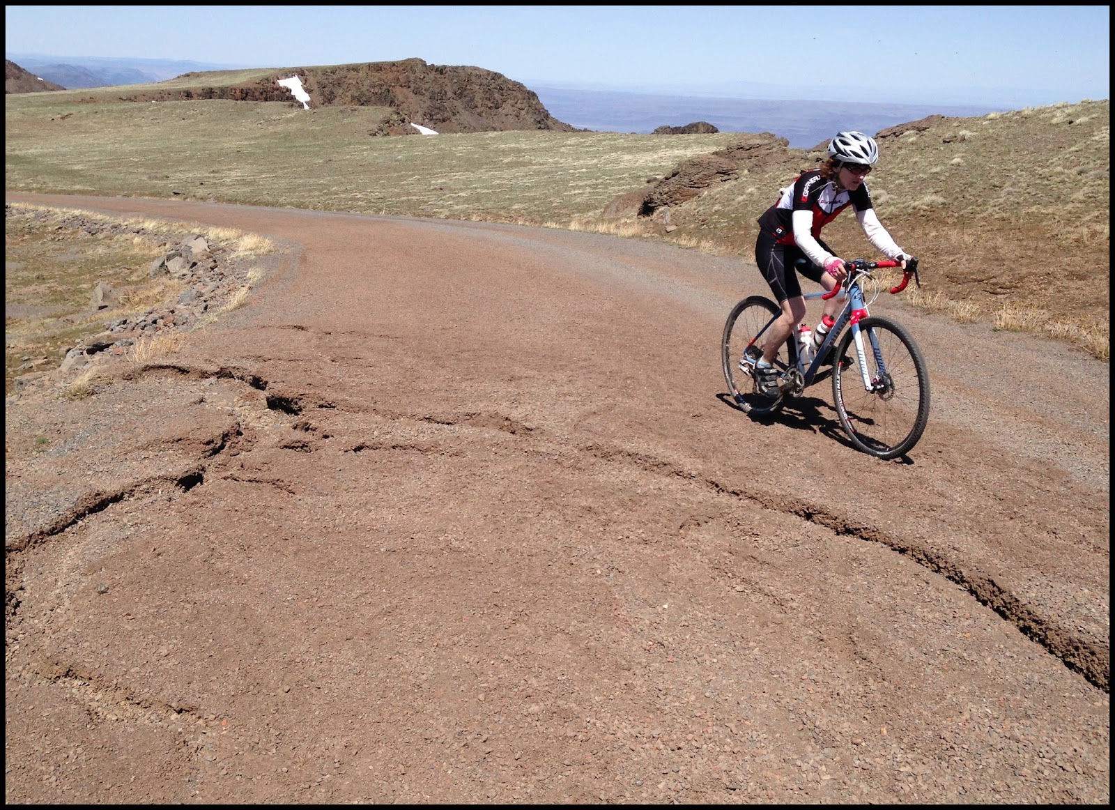
Fast forward to this summer and our shiny new gravel bikes. Apparently the road up to Hat Point had made quiet an impression on Chris, because all summer he kept saying he wanted to ride it. So, with the door closing on nice weather we decided to make a beeline for it a couple of weekends ago when the temperature was predicted to be sunny and dry.

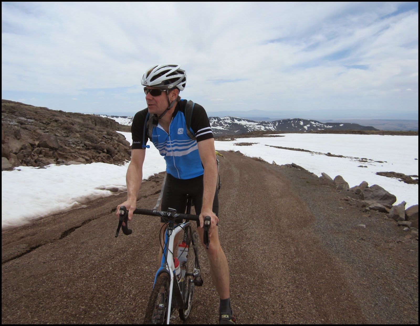
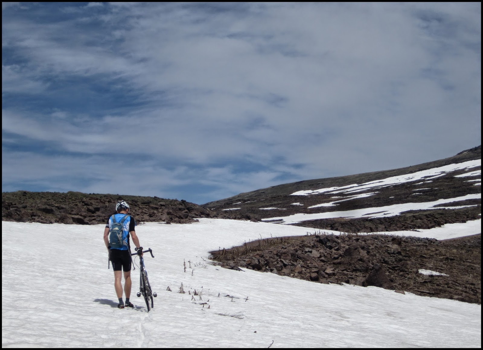
The first section of the climb was too steep for me so I dropped Chris at the bottom and drove 6 miles up. Chris caught up with me after about an hour+ and we rode together to the top. It was, unfortunately, the first day of hunting season, but the hunters were all very pleasant (their hopes and dreams of baggin' the big one still intact) and nobody (such as us) got hurt.

Hat Point Lookout
Ellen: 36 miles, 3,894 feet of climbing
Chris: 42 miles, 7,369 feet of climbing


The only store in Imnaha was celebrating its 100th anniversary;
Chris's ride began here

I skipped the toughest section,
parking 6 miles up the road from Imnaha

making my way up


at the top;
Seven Devils in the background

Chris climbed the steps up the tower;
 my legs were tired so I chose to rest them before the return trip


plaque hanging on the observation tower

Chris exploring Hat Point

heading back;
as usual our late start meant we'd finish at sunset

back at the car, just in time

another sunset in the bag

Last time we visited Joseph we stayed at the Wallowa Lake Lodge. It was built in 1923 and is situated outside of town at the edge of Wallowa Lake. We didn't stay at the Lodge this time, why, I don't know. But the day after our ride returned there for breakfast, which we remembered as being quite good. It did not disappoint.


Wallowa Lake Lodge

Pancakes and bacon;
yes, the pancakes are the size of the plate

As I mentioned, we were last here 15 or so years ago. I think I also mentioned that at that time we took a very tough hike to Ice Lake. Here we were, on the lawn of Wallowa Lake Lodge, 15-ish years ago, the morning of the hike. I distinctly remember NOT wanting to go on the hike, but to lounge for the rest of the day in that chair.


please don't make me go on a hike

Here we are, a few weeks ago, returned to the scene of the crime:


so happy not to be going on a hike


Thursday, September 25, 2014

Squirrels

A young squirrel has been visiting our backyard. I normally buy a bag of unsalted peanuts-in-the-shell and throw them to the squirrels and jays during the winter. The other day I bought a squirrel food-log (for lack of a better name) and hung it on a low tree branch off the back porch where I could watch him go at it. He seems to have gotten the hang of it. But I will feel very bad if a cat gets him so I will probably move the food somewhere he can safely climb off the ground. In the meantime, it makes for some fun squirrel photos:


Wednesday, September 24, 2014

Crater Lake National Park

Vehicle Free Day

Crater Lake National Park was established in 1902. It's the 5th oldest national park in the United States and the only national park Oregon. The lake is 1,943 feet deep at its deepest point, which makes it the deepest lake in the United States. But the most amazing feature about the lake is its color, a stunning deep blue that can only really be appreciated when standing on the rim of the crater.

A 32-mile road loops around the crater. Last year for the first time the park tested a vehicle-free zone covering 24 miles of the loop. Cars could access the west side of the rim via two park entrances and drive the 7-8 miles between the entrances but the rest of the loop was left to cyclists and walkers. The test went well so the park decided to establish two vehicle-free days annually. Somewhere in the back of my head this information must have been rolling around because when were trying to decide what to do last weekend I remembered hearing about this car-free thing. A quick internet search showed we were in luck: vehicle-free days were scheduled for September 20 and 27. Off we went.

It's folly trying to get a room at this national park lodge a few days in advance, but we did try. No, this lodge, with it's amazing setting on the rim of the crater, is booked solid a year in advance. The lodging closest to the exterior of the park boundary is pretty sketchy (dank little motels) so we opted to stay instead in Bend, about 90 miles north of the park. Crater Lake lies at about 7,000 feet and is covered in heavy snow 8 months of the year, but on this day the weather was spectacular. Except for the fact that I wasn't in shape for this kind of ride it was perfect cycling conditions. We added some extra miles via an offshoot road in the park which was also closed to cars. Total damage: 47 miles, 4905 feet of climbing. 


the star of the show

clouds reflecting in the lake

checking out some other scenery

I think I said I wasn't in shape for this ride
This is about 40 miles and 4,000 feet into the ride
Oh man, I was hurting...


... but nothing an ice cream cone* couldn't cure
(courtesy of the gift shop)


resting up for the last few miles 

nearly there


finished !

Chris always has to get on the edge of whatever it is we are near


the best part of any ride


Thursday, August 7, 2014

Abomination


Summer in Oregon brings an event ride called The Oregon Coast Gravel Epic. It's promoted as "an endurance event that showcases the raw beauty of ancient Siuslaw National Forests and some of its seriously stout hills." The longer route, Abomination, is 70 miles. The shorter route, aka Son of Abomination, is 35 miles. The problem with "event" rides such as this is the cost (for this event, around $100 per person), and, the rides start too early in the morning. So we decided to make our own event and ride Son of Abomination on Friday. Then, on Saturday, Chris took off for another gravel ride while I toured the beaches south of Yachats.

Son of Abomination: 32 miles, 3,800 feet, 50% gravel
Chris's Saturday Special: 64 miles, 9,600 feet, 65% gravel


after a hard ride you get to eat one of these guilt free

classic Oregon beach; ain't nobody else around

okay, there was this one guy


rare sighting -- Chris on a beach


On the drive back to Portland on Sunday we took a minor detour to the Otis Cafe, located a few miles south of Neskowin. The Otis specializes in homemade bread (molasses, pumpkin, wheat sourdough) and pies (apple, berry, peach and more) But we had breakfast.... at 3pm. Their cinnamon toast will practically kill you with its buttery goodness. Homemade wheat bread cut 1 inch thick slathered in butter and cinnamon. Wow!


Otis Cafe
if you go, pay special attention to that little black board up on the wall; yum


Thursday, June 19, 2014

Steens Mountain

Frenchglen

It's been about 10 years since we visited southeastern Oregon. We thought it was time to go back so we loaded the car and drove to Frenchglen, not too far from the Nevada border. Population, maybe 30. Frenchglen has an old hotel, a mostly empty mercantile store, a couple of gas pumps, and that's about it. The big draw is that it borders Malheur National Wildlife Refuge, a migration stop for thousands of birds in April, May, and September. It's also at the doorstep of Steens Mountain, which stretches about 50 miles north to south and summits at 9,733 feet. And not too far away is the Hart Mountain National Antelope Refuge. The birds are a nice touch but we came to ride up Steens, which has the highest road in Oregon.

If you turned a horseshoe upside down, the left side of the horseshoe would be the north road going up Steens, and the right side of the horseshoe would be the south road going up Steens. The entire horsehoe is gravel road of about 50 miles. Connecting the two ends of the gravel road together is a paved road of about 10 miles. This is the road that runs through Frenchglen, which sits at the base of the north-gravel road.


Frenchglen Hotel

Steens Mountain - South Road
Due to snow it is possible to drive the entire Steens road (the gravel horseshoe) only 2 or 3 months of the year. The BLM has a series of 5 gates on the road and each gate is opened for car traffic only after the snow has melted on that section of the road. Only the lowest gates on the road were open when we were there. Too bad for cars, but good for bikes. Sort of.

gated South road; the adventure begins

a little winter debris still on the road

cycling up the south side; still a long way to go

beautiful scenery, all to ourselves

uh oh........

snow!

tough going

what's doesn't belong in this picture? 
(hint: it's white and cold and you love it when you're a kid but not when you're on a bike)

 I gave up riding the south road after the fifth patch of snow. Chris soldiered on and made it nearly to the top.

Near the top of the south road
Alvord Desert in the distance


On the drive back to Frenchglen we saw these horses. I know they look like regular old horses, but they are part of a large herd of wild horses that roam the area. Some people visit the Steens just to try and get a glimpse of the wild herds... out in the distance... through binoculars. We lucked out coming across these guys without even trying to find them.

wild ponies


Steens Mountain - North Road
Because we are stubborn, the next day we tried for the top again, this time up the north road. Chris started at the bottom while I drove the car 10 miles further before starting my ride. Snow again, but not as bad as the south road. Success! We reached the top of Steens Mountain.


Chris makes his way up

large cracks in the road


last stretch to the top; this section was really steep

Chris is never satisfied riding to the top of the road;
here, he rides up just a little bit further

Made it !
Alvord Desert in the distance

highest road in Oregon